
Nathatop Guide: Himalayan Views, Snow & Paragliding
The highest viewpoint between Patnitop and Sanasar. Here’s what to see, what to know before you go, and why the road ahead to Sanasar is where your trip really begins.
Altitude
Approx. 2,711 m
From Patnitop
Approx. 11–14 km on the road to Sanasar
Time Needed
1–2 hours; stay overnight in Sanasar
Nathatop is the highest viewpoint in the Patnitop area, at around 2,711 metres. On a clear day you can see across the Chenab valley to the Kishtwar Himalaya and the dramatic peaks of the Brahma massif. It sits on the road between Patnitop and Sanasar, so most travellers stop here for the view on their way to the meadow.
Things to Do at Nathatop
- Himalayan views and photography: go early in the morning for the clearest skies and the best light.
- Paragliding: Nathatop’s open, treeless slopes are popular for tandem flights in good weather. Always fly with a registered operator.
- Snow play: from late December to February the slopes turn white, ideal for sledging and snow photos.
- Roadside snacks: small stalls sell tea, maggi and local snacks in season.
Know Before You Go
- Army area: Nathatop has a military presence. Respect restricted zones and do not photograph defence installations.
- Basic facilities: there is little tourist infrastructure. Carry water and snacks, and plan toilet breaks in Patnitop or Sanasar.
- Narrow road: drive carefully, especially in snow or fog. The road can close after heavy snowfall.
- No stays: there is nowhere to stay at Nathatop itself. Plan your night in Sanasar or Patnitop.
- Cold and windy: it is noticeably colder than Patnitop, so carry a warm layer even in summer.
Best Time to Visit Nathatop
March–June and September–November bring the clearest views and the best paragliding conditions. Late December–February is snow season: magical, but check road conditions before you set out. Avoid July–August, when monsoon clouds often hide the peaks.
How to Reach Nathatop
Drive to Patnitop (approx. 110 km from Jammu), then continue about 11–14 km uphill to Nathatop. From there, the road carries on to Sanasar, a short drive away. A taxi from Jammu or Katra can easily cover Patnitop, Nathatop and Sanasar in one trip.
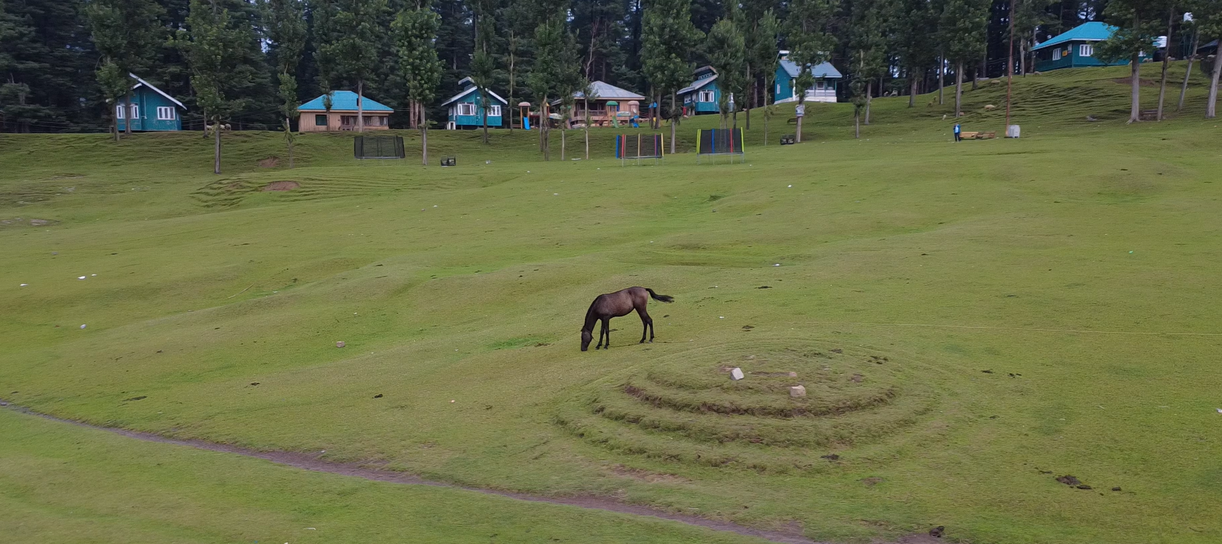
Nathatop Is the View. Sanasar Is the Destination.
Nathatop is a wonderful stop for an hour. But keep driving: just down the road lies Sanasar, a sheltered, cup-shaped meadow with a lake, forest trails and places to stay. It is where travellers who stop at Nathatop end up spending their day.
- Shikara rides on Sanasar Lake
- Horse riding, zipline and zorbing on the meadow
- The Shank Pal Temple trek
- Homestays, huts and camps for the night
Nathatop vs Sanasar
| Nathatop | Sanasar | |
|---|---|---|
| Altitude | Approx. 2,711 m | Approx. 2,050 m |
| Best for | Views, paragliding, snow photos | Meadow, lake, activities, overnight stays |
| Time needed | 1–2 hours | 1–2 days |
| Facilities | Very basic | Food, homestays, huts and camps |
| Stay overnight? | No | Yes |
Frequently Asked Questions
Where is Nathatop?
Nathatop is above Patnitop in the Jammu region, about 11–14 km by road, on the route to Sanasar.
Can you stay at Nathatop?
No, there are no stays at Nathatop. Most visitors stay in nearby Sanasar or Patnitop.
Does Nathatop get snow?
Yes. Nathatop usually gets snow from late December to February, and the road may close after heavy snowfall.
Is paragliding available at Nathatop?
Paragliding is popular at Nathatop in good weather, mainly in spring and autumn. Availability depends on weather and operators, so confirm locally.